Wakago Fishing Port at Nii-jima Island, Izu Seven Islands
34 25.150N 139 16.600E
| 【Berth】 | |
| |
|
| 【Berth】 | |
| |
Wakago Fishing Port at Nii-jima Island, Izu Seven Islands
google map Nii-jima Port at Nii-jima Island→Wakago Port at Nii-jima Island
google map Wakago Port at Nii-jima Island→Motomachi Port at Ohshima Islan
May 20, 2012
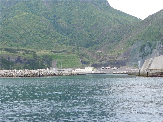
Approaching Wakago Port:
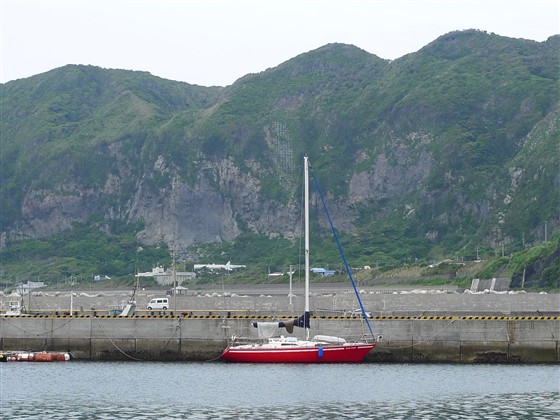
You may have whole view of Wakago Port at 34 25.220N 139 16.700E. Passing by a red lighthouse on your right, you move into the
port.
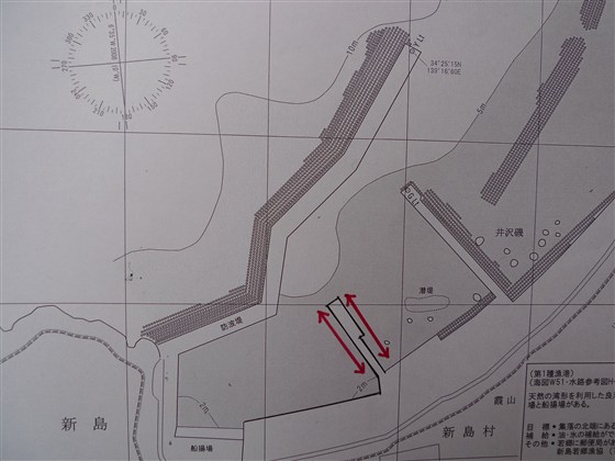
Berth at Wakago:
A local fisherman suggested me that you may moor at the jetty on your left
in the innermost boat pool.
A Japanese sail magazine introduced mooring at the jetty on your right
just after rounding the red lighthouse.
But, as it faces to outside, it will be a rolling berth on non-quiet days.
A fisherman allowed me to use a water tap with a long hose at the end of
the warehouse in front of me.
The nearest 24-hour-open Japanese style toilet is at the end of Gyokyo
, Fisheries Cooperative Association, building.
There is a western style toilet at the end of Wakago Maehama Beach, which
is far from the berth.
To enjoy Onsen (Spa), you have to take a bus to Nii-jima Port area.
Three Onsen bathhouses are shown on my page of Nii-jima Port.
There are two small shops which deal in vegetables and meat for your provisioning.
There is no restaurant or no coin laundry.
I didn’t check the availability of fuel.
Additional Information for English Version
Nii-jima Village consisting of islands of Nii-jima and Shikine-jima has
English translatable website:
https://www.niijima.com/index.html
Tokai Kisen, a ferry company for Izu Seven Islands, has English introduction
of each island:
http://www.tokaikisen.co.jp/english/island/niijima/
Kuroshio, a strong ocean stream, is running through Izu Seven Islands.
As Kuroshio changes its course frequently, visit Japan Coast Guard’s weekly-updated
report:
http://www1.kaiho.mlit.go.jp/KAN3/kaisyo/kaikyo/sokuho/sokuho.html
Return to Cover Page